On the Real Watership Down
On to Ecchinswell
The rabbits flee Cowslip’s Warren and head further south to the area around the village of Ecchinswell.
Since the previous morning they had journeyed nearly three miles. Their luck had been good, for everyone who had left the warren was still alive. They had splashed through two brooks and wandered fearfully in the deep woodlands west of Ecchinswell. They had rested in the straw of a Starveall, or lonely barn, and woken to find themselves attacked by rats. Silver and Buckthorn, with Bigwig helping them, had covered the retreat until, once all were together outside, they had taken to flight. Buckthorn had been bitten in the foreleg and the wound, in the manner of a rat-bite, was irritant and painful. Skirting a small lake, they had stared to see a great, grey fisher-bird that stabbed and paddled in the sedge, until a flight of wild duck had frightened them away with their clamour.
They had crossed more than half a mile of open pasture without a trace of cover, expecting every moment some attack that did not come. They had heard the unnatural humming of a pylon in the summer air; and had actually gone beneath it, on Fiver’s assurance that it could do them no harm. Now they lay under the spindle-trees and sniffed in weariness and doubt at the strange, bare country round them.
Chapter Eighteen—Watership Down
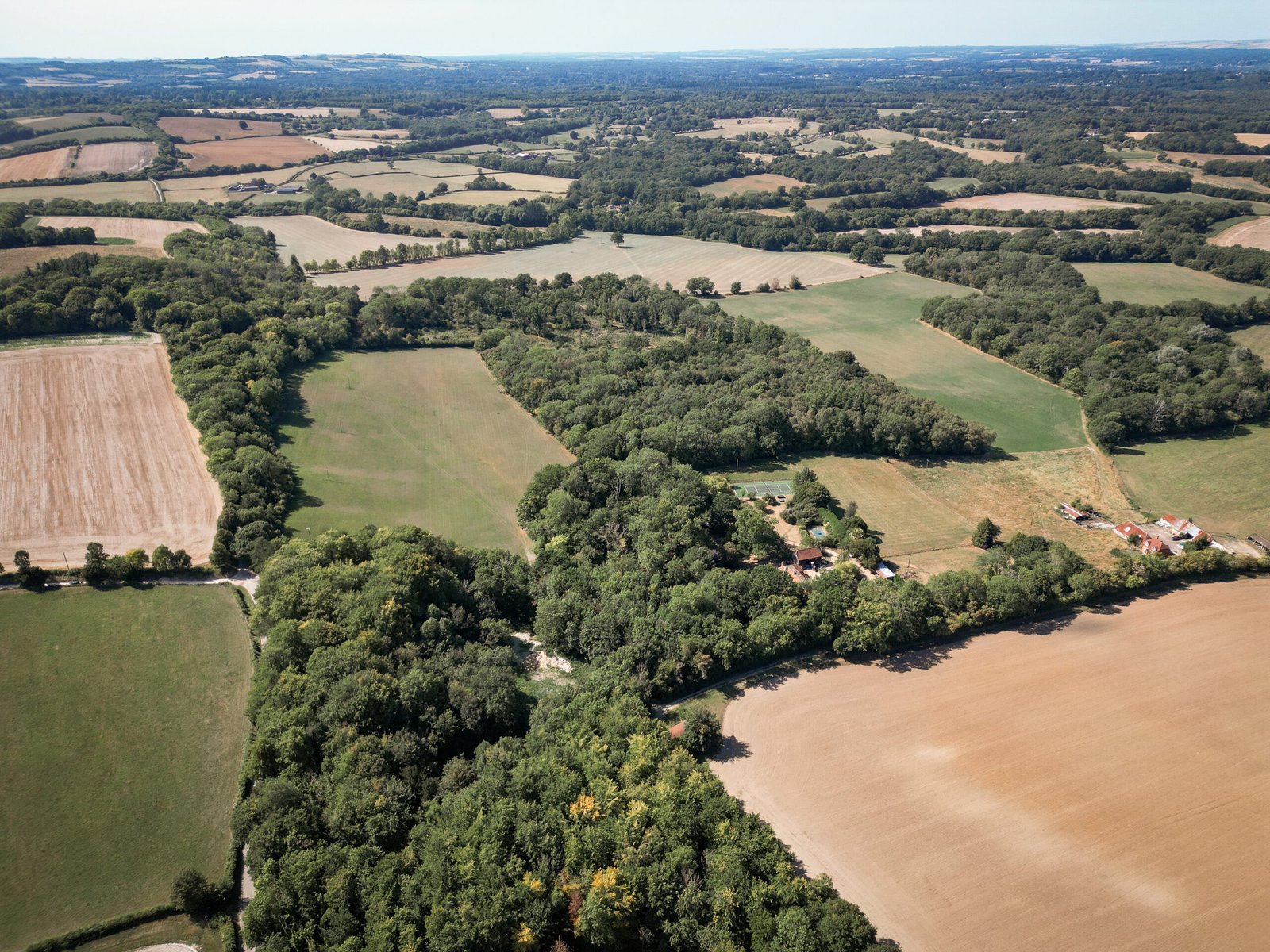
Upper Berry Wood sits behind the tennis court. Lower Berry Wood is to the right, over the field. The orange-roofed barn is in the central foreground.
The rabbits’ final day of journeying to Watership Down is condensed into just a few sentences within Chapter Eighteen, Watership Down. This leg from Cowslip’s Warren was ‘nearly three miles’, meaning the group must have travelled a very direct, straight path. On their way, the rabbits crossed two brooks, woodland west of the village of Ecchinswell, rested and then were attacked by rats in a ‘lonely barn’, passed by a small lake and, finally, crossed half a mile of open pasture. That’s a lot to cover, so we will look at each in turn:
‘Two Brooks’
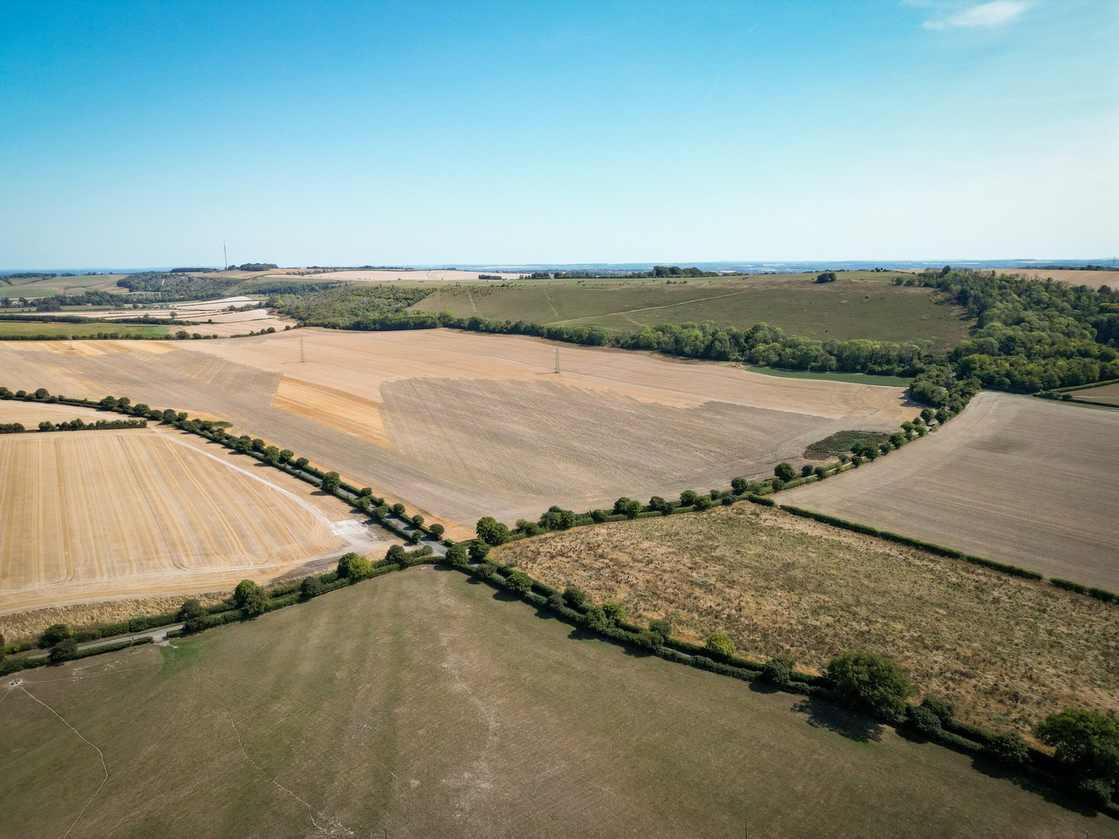
Contemporary and historical mapping suggests the two brooks Adams mentions are north-west of Woodside Farm on Cow House Lane. The two waterways are in close proximity to each other and form two of the boundaries in one field.
The field we are interested in is on the left of the picture below, with one corner extending out into the central foreground. The brooks, almost certainly drainage ditches, are in the tree-lines that mark the upper and lower boundaries.

The brooks are in the two tree-lines forming the perimeter of the harvested field on the left.
‘Deep woodlands west of Ecchinswell’
Adams use of ‘woodlands’ as a plural, alongside the three mile travel distance, suggests the rabbits passed through the eastern reaches of Lower Berry Wood and Upper Berry Wood. Old maps show the pair were conjoined in the 20th century at their western edges by a wood called Hobb’s Copse. However, a diversion through here would have taken the hlessil over the three mile mark.
A 360 degree view of the area west of Ecchinswell.
‘A … lonely barn’
I anticipated that after passing through the woods, the rabbits would have crossed Well Street, heading down the steep slope towards Watership Farm. At some point between here and reaching the lake due south, the rabbits take some rest inside a ‘lonely barn’. After being attacked by rats, they retreat south. (Of course, the rat attack was relocated from the barn to an outbuilding at Newtown Church in the 1978 movie.)
Having checked aerial photos dating back as far as 1999, I drew a blank on finding a barn in the vicinity of Watership Farm. One possible answer comes from a 1919 Ordnance Survey map where an isolated building of some kind is shown on the northern boundary of a field directly to the north of the farm. This building can still be found on a further map from 1958. It is also visible in an aerial image from 1948, but it is hard to draw any conclusions as to its purpose.
There is one other possibility when it comes to the ‘lonely barn’. What if the rabbits had not crossed over Well Street, but headed east a short distance after leaving Lower Berry Wood and crossed over Cow House Lane? They would have come to an isolated, open-sided Dutch barn used for the storage of hay. It certainly fits the bill although I have no details as to when it was erected. Curiously, this structure (or an earlier one) does not feature in the map for 1958 or its previous equivalents, but can be found in the same 1948 photograph as mentioned above.
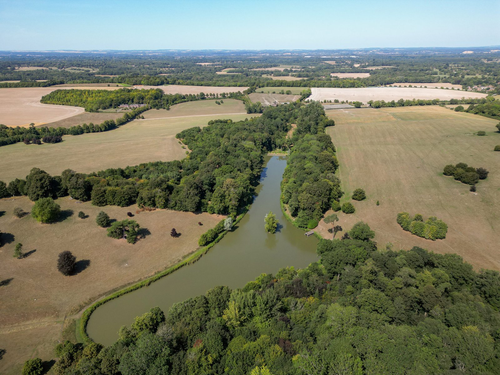
North over the lake and Watership Farm. I expect the rabbits will have passed to the right.
‘A small lake’
The lake ‘skirted’ by the rabbits sits in the landscaped section of Andrew Lloyd Webber’s 5,000 acre Sydmonton Estate. Given the three mile travel limit, the rabbits would have passed to the east, heading south and roughly parallel to the Ecchinswell Road.
‘Half a mile of open pasture’
From the lower tip of the lake, Hazel and his band would be roughly north-west of Watership Down, about half a mile from the power line. To reach the ‘great field’ under Watership Down and its pylons, the rabbits would have made their way across land that provided them with very little cover. If that didn’t present enough danger they would also have needed to cross both roads that meet at the Sydmonton Crossroads.