On the Real Watership Down
The Bridges
With the Watership Down rabbits and Efrafan does aboard a small punt, they are washed downstream and must face the dangerous hazard of two low bridges.
Well out from either bank stood four low arches—scarcely more than culverts, each filled by the stream to within a foot of the apex. Through them, thin segments of daylight showed from the downstream side. The piers did not project, but against each lay a little accumulation of flotsam, from which driftweed and sticks continually broke away to be carried through the bridge.
It was plain that the punt would drift against the bridge and be held there. As it approached, Hazel dropped back into the bilge-water. But this time there was no need. Broadside on, the punt struck gently against two of the piers and stopped, pinned squarely across the mouth of one of the central culverts. It could go no further.
Chapter Thirty Nine —The Bridges.
Attempting to visit the plank, upper and lower bridges on the River Test has proven to be a frustrating experience. All three are inside Laverstoke Park, a large country estate hidden behind high hedges and security gates.
I initially tried to take a photo of the Lower Bridge—where the rabbits’ punt came to rest in Chapter Thirty Nine, The Bridges—through a gap in the hedgerow from the side of the B3400, though the results were extremely disappointing. Instead, I found a quiet place back from the road and launched my drone up into the air. Sadly, the trees prevented me from getting a decent image of the bridge, though I did get a reasonable view over the pond towards the mill that is now the Bombay Sapphire gin distillery and visitors centre:
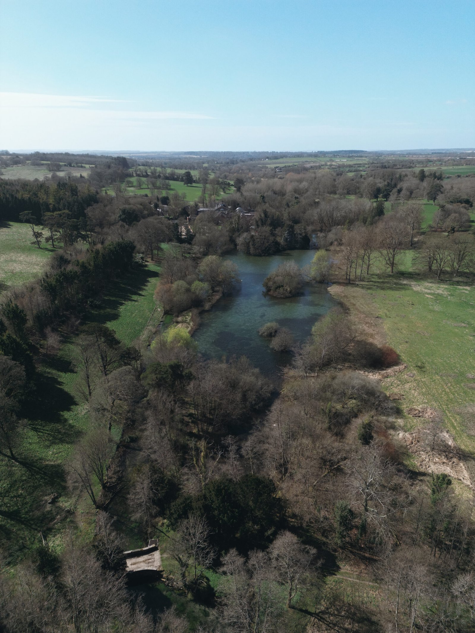
Lower Bridge (bottom-left) looking over to the mill pond and the Bombay Sapphire Visitors Centre in Laverstoke.
This photo indicates how the use of the river between the mill pond and Lower Bridge has changed.
Within Chapter Thirty Nine, Adams writes:
‘There was a kind of swamp here and it was hard to tell where water ended and woodland began. Plants grew in clumps both in and out of the muddy shallows. The bottom was covered with fine silt and mud that was half water and in this the two rabbits had made furrows as they dragged themselves to shore. Running diagonally across the pool, from the brickwork of the bridge near the opposite bank to a point a little below them on their own side, was a grating of thin, vertical iron rods. In the cutting season the river weed, drifting in tangled mats from the fishing reaches above, was held against this grating and raked out of the pool by men in waders, who piled it to be used as compost. The left bank was a great rubbish-heap of rotting weed among the trees. It was a green, rank-smelling place, humid and enclosed.’
Today, that weed pool seems to no longer exist, being just a short section of river spanning from the bridge into the mill pond. This means the ‘left bank’ is no longer used to pile weeds for compost, though it is the most southern point the rabbits explore in the novel.
The treeline in the left of the image that is casting shadows towards the river bank conceals the B3400. This is the road, described in Chapter Forty, The Way Back, as being ‘busier than any they had known.’

The three arched bridge at Freefolk, just a short distance downstream from the mill pond.
Despite not being able to get a good photo of the Lower Bridge from the roadside, it is not too dissimilar from other bridges across the Test at Bere Mill in Whitchurch, and nearby Freefolk (see above). This latter pair are three-arched bridges, whereas Lower Bridge has four.
I was also unable to get a meaningful image of the Upper Bridge where, in Chapter Thirty Nine, Acorn and escaping Efrafan doe Thrayonlosa were struck by a low beam as the punt passed underneath. It shows how times have changed that, in 1983, Chris Boyce was able to walk through the Laverstoke Estate to visit the bridge in person and take photos of what he found. I can only dream of such an opportunity.
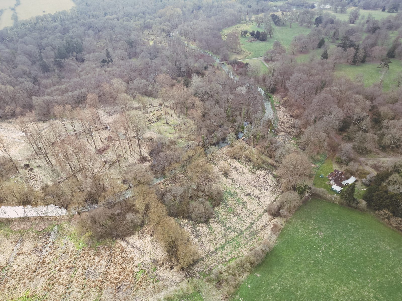
The best I have been able to muster is this aerial shot taken close to the plank bridge, showing the Test as it curves around and down to the Upper Bridge, then turning right to complete an S-shape along to the Lower Bridge (concealed behind trees) and the mill pond: